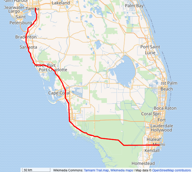
History of Tamiami Trail
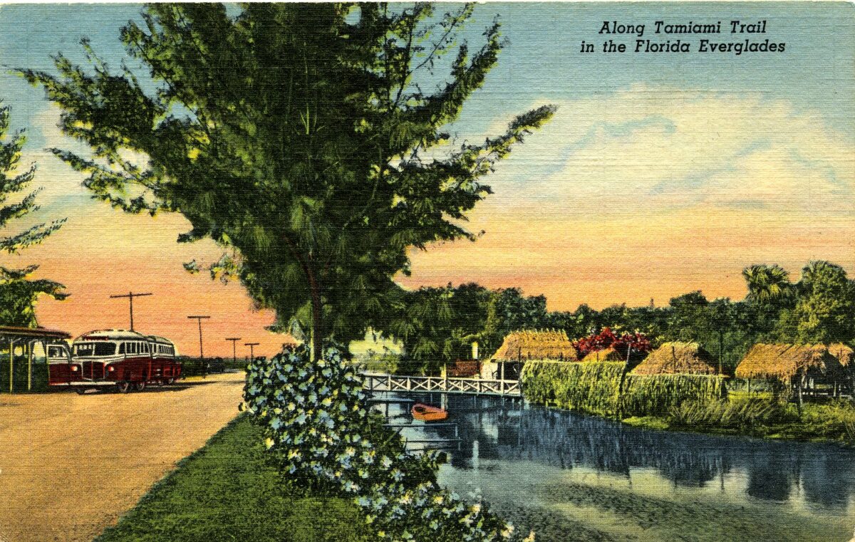
If you have ever driven in South Florida, chances are you have driven on Tamiami Trail. Also known as U.S. Highway Route 41, this long stretch of road , as its name suggests, connects Tampa to Miami. Today, Tamiami Trail has been outpaced by faster routes like Alligator Alley (a portion of I-75). But in its heyday, the Trail was considered a feat of civil engineering. Connecting Tampa and Miami across the Everglades was a dream just out of reach at the beginning of the 20th century. So, how did it come about? Grab some snacks for the road! Join us as we dive deep into how this trail transformed the state of Florida, and Florida tourism, forever.
The Dream
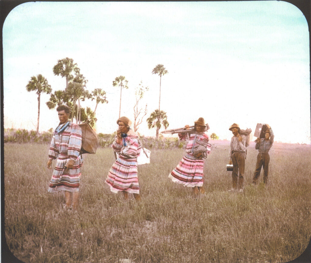
Possible Survey Group on TT, 1919, Catalog 2001.3.2, ATTK Museum
In the beginning of the 20th century, the idea of a trans-peninsula highway seemed like just a dream. How can you tame the Everglades? If you recall in last week’s post, the Everglades of today is vastly different than it was a hundred or more years ago. There were no roads bisecting the Everglades, and the sheet flow was a free moving body of water. Lake Okeechobee was almost twice the size it is today. In the wet season, water flowed down the peninsula from Lake Okeechobee in a slow moving river. Since Florida is almost entirely flat, the driest portions were hammocks dotted among swamp and sawgrass. Traversing Florida was difficult, dangerous, and not for the faint of heart. Conversations between movers and shakers in Miami, Tampa, and Fort Myers began to envision a connecting highway that would cut through the swamp.
So, in 1915, with the pressure of powerful men from many of Florida’s biggest cities, the Board of Commissioners of Dade County agreed to fund part of the highway. The rise of personal automobiles drove a lot of interest in connecting these cities. People wanted to come to Florida, but the money and time it cost to move around the state was a drawback. Dade County sent out their own county engineer for the project. The Tamiami Trail would eventually span over 260 miles, but it started out much smaller. About 3.5 miles of were surveyed within days, and the construction of the Tamiami Trail had officially begun. To the right, you can see a photo of a possible survey group surveying for construction on Tamiami Trail in 1919. Three men in traditional bigshirts carry photo and survey equipment through tall grass. Two white men trail behind the trio.
The Reality
Tamiami Trail, via Wikimedia Commons
But, cutting through the Everglades wasn’t as easy as they envisioned. The stretch across the Everglades was much harder to traverse than they expected. The limestone was deep, and the conditions sweltering. The project ran out of money multiple times. It wasn’t until 1923, when Barron Collier provided funding, that the project began to gather steam. In exchange for the trail going through a new county named after him, Collier agreed to fund that section of the project. Thus, Collier County in Southwest Florida was established. Internal arguments between those who favored a coastal route or an inland route caused rifts. LaBelle, which would have been on the inland route, may have been a South Florida powerhouse if things had developed differently. Eventually though, the Tamiami Trail was “complete.” The grand opening of the Tamiami Trail was on April 26th, 1928.
The Tamiami Trail was an extremely laborious, expensive project to complete. Over 2,000 workers back-breakingly carved, blasted, and scraped their way along the designated route. After some false starts, the last 5 years saw most of the Trail’s completion. In total, the Tamiami Trail cost around $8 million at the time. That would be over $128 million adjusted to 2022 dollars. Cutting out the Trail also used over 2.6 million sticks of dynamite. Even spread out over 13 years, that is a significant amount of explosives! The efforts to build the Trail literally paved the way for the South Florida of today, for better or worse.
How the Trail Changed Florida
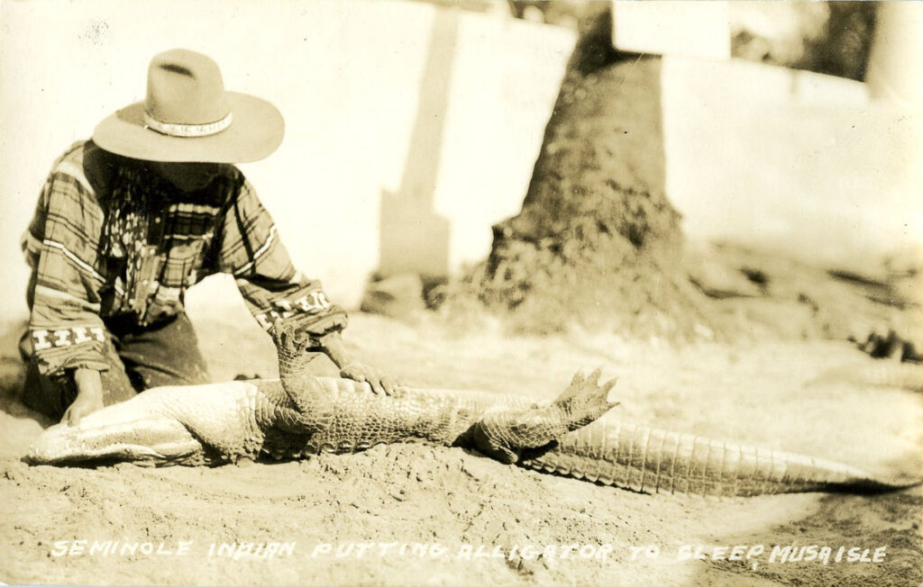
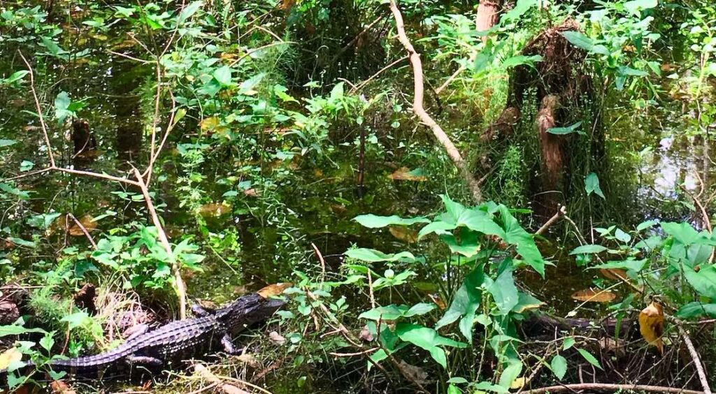
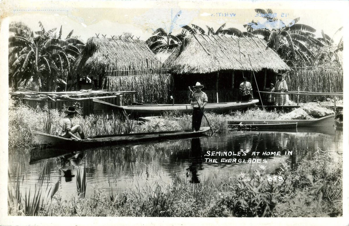
Prior to the construction of Tamiami Trail, most people navigated South Florida by boat. This was time intensive, and didn’t allow for much cross-state travel. After the hardest part across the Everglades was completed, new doors opened for Florida tourism. Not only did the Trail provide an open road for tourists, it also became its own sight to see. Tamiami Trail runs through some of the most beautiful land in South Florida. From the Trail you can spot alligators, a multitude of birds, turtles, and other wildlife. Like discussed in last week’s post, tourist camps began to pop up on Tamiami Trail around its time of construction. Seminole and Miccosukee camps were plentiful, and tourists could pay for exhibition shows, crafts, food, and more. Tamiami Trail still draws crowds today, and it is the home to some of Florida’s most beautiful sights.
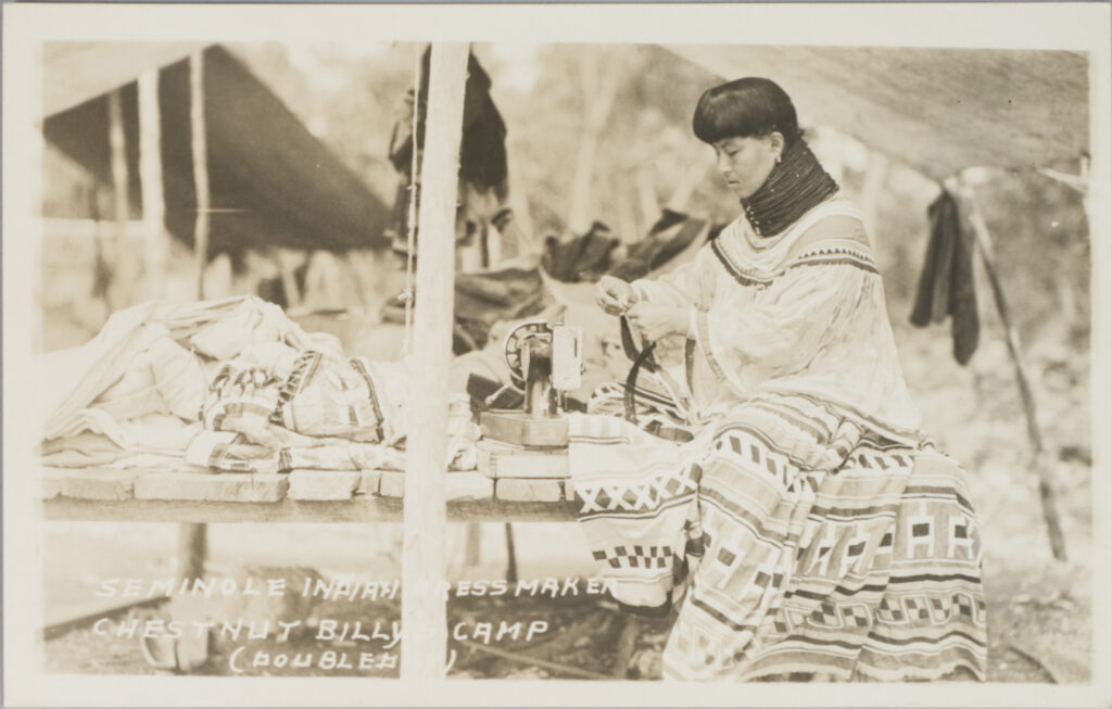
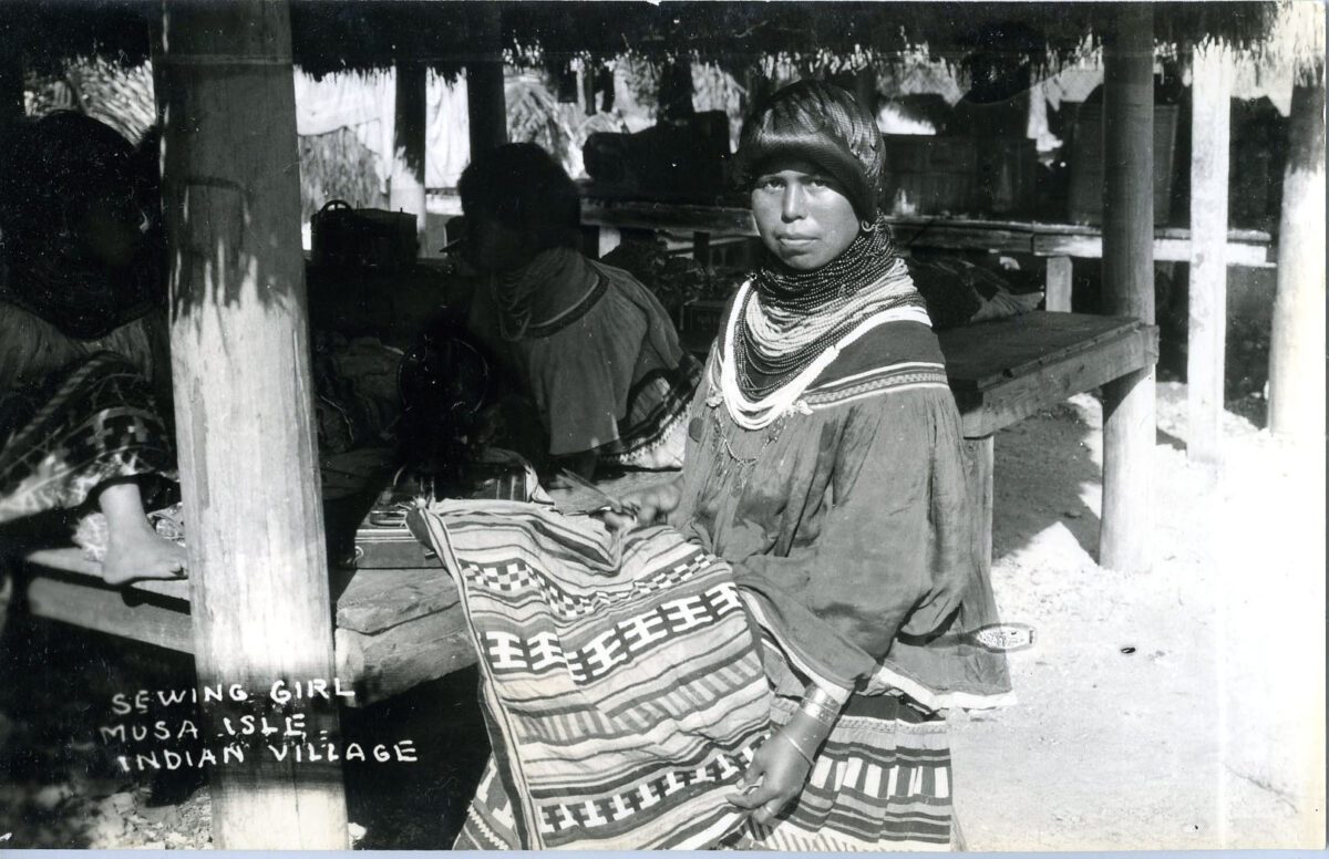
Changes to the ecosystem significantly impacted the lives and livelihoods of native people. They were forced to adjust, and with this came the rise of those tourist camps. Read more about the rise of tourist camps here with last week’s post. These two real photocards show images from two different camps. Musa Isle Indian Village in Miami was one of the more famous Seminole tourist camps. The other photocard shows Jane Tiger Motlow, a well-known patchwork artist, using a hand-crank sewing machine at Chestnut Billy’s Camp on the Tamiami Trail. She and her husband, John Motlow, would live on Tamiami Trail before moving to the West Palm Beach area.
Real Postcard, 1932, Catalog 2000.31.2, ATTK Museum
Real Postcard, Catalog 2001.34.2, ATTK Museum
The Future
But, with that significant upgrade of infrastructure came heavy costs, and not just financial ones. Tamiami Trail effectively cut through the heart of the Everglades. This, coupled with the drainage project and damming of Lake Okeechobee, struck a heavy blow to the natural ecosystem. The sheet flow was interrupted by the roadway, and the slow moving river shrank. Learn a little bit more about how Everglades biodiversity has changed here in a previous post. During its construction, the builders did not explore how the surrounding ecosystem would handle water drainage projects and road construction. Tamiami Trail is one of the primary barriers to water flow in the Everglades. But, there have been efforts made to mitigate the damage done by the construction, including the construction of a small number of culverts and waterways in the 1990s.
However, the conservation vision did not really take shape until the early 2000s. Money was allotted to elevate a small section in Everglades National Park, remove road fill, and provide maintenance to causeways already in place. This bridging project was only the first in a series of many. In the last twenty years, a number of other projects have been initialized to raise the roadway to allow water and wildlife to pass underneath. Adjustments were made to make sure water was being distributed evenly. Portion by portion, sections of the roadway have been slated for bridging. In 2020, the final phase of the project was funded with aims to have it completed by 2024. Conservation projects like this hope to help this unique ecosystem thrive.
Seminole Tribe of Florida Role in Everglades Restoration
 The Seminole Tribe of Florida takes an active role in Everglades restoration, advocating for the health and continued support of Seminole ancestral lands. One such project is the Everglades Restoration Initiative. This project “is designed to mitigate the impacts of development on the environment; more specifically, to improve water quality, to increase water storage capacity, and to enhance hydroperiods.” The program has the support at both the state and federal level, and “will have a significant impact on the quality and quantity of water flowing off of the Big Cypress Reservation and into the Florida Everglades.” The Seminole Everglades Restoration Initiative is an ambitious, long-term project, and shows the commitment of the Tribe to conservation efforts.
In addition to this, the Heritage and Environment Resources Office (HERO) of the Seminole Tribe of Florida is working hard to further conservation efforts while also advocating for the tribal perspective. For example, HERO is dedicated to monitoring and representing the Seminole voice in other agency projects. The Western Everglades Restoration Project (WERP) is a U.S. Army Corps of Engineer’s Planning project. It is part of the Comprehensive Everglades Restoration Project (CERP) meant to “help restore, reconnect and maintain these areas with the natural areas to the south.” But, some of the proposed actions could affect tribal reservation land. The HERO is working to help shape projects like this to acknowledge and include Seminole perspectives into its framework and implementation. To look at other HERO case studies, please visit their website here.
What is there to see?
Take a peek below for a few of the exciting tourist stops available on today’s Tamiami Trail. Don’t forget your water and sunscreen, because you can’t see these sights without exploring a little!
Miccosukee Indian Village
The other federally recognized tribe in Florida, the Miccosukee Tribe’s Indian Village is located off of Tamiami Trail. Politically distinct from the Seminole Tribe of Florida, the Miccosukee Tribe shares many cultural ties. The Miccosukee Indian Village has a Museum, gift shop, Alligator shows, and a casual eatery on location. Actual Miccosukee camps, along with Traditional Independent Seminole camps, can be seen along the Trail.
Smallwood Store at Chokoloskee
Established in 1906, Smallwood Store was one of the many trading posts in South Florida. To see more information on the relationships built between trading posts and Seminole people, read a previous blog post here.
Everglades National Park
Established to protect this fragile ecosystem, Everglades National Park is a must see right off of Tamiami Trail. Comprised of over 1.5 million acres, visitors can see birds, manatees, alligators, and more in this precious Florida resource. To learn more about Everglades biodiversity, read a previous blog post here.
Big Cypress National Preserve
Big Cypress National Preserve covers 729,000 acres of Big Cypress Swamp. National Preserves differ from National Parks in that, in addition to protecting resources, they also allow activities such as hunting, as long as natural values are preserved. The Seminole and Miccosukee tribes both have traditional and customary use rights on Big Cypress National Preserve.
Jayne Campbell
I was raised in Florida. I had never heard of the Miccosukee Indians in Florida;only the Seminoles.
I am glad to hear that animal underpasses are being constructed for the animals to use to move around freely while searching for food.
Carey
Super amazing history….wow what a story. I’m doing a paper for school on the project that started in 1915. Looking forward to taking a road trip soon to check it out!! Can’t believe I’ve been in Florida my entire life and have never driven down that road!!
CHRISTINE HICKS
My grandfather worked on this CCC project. He drove mules.
Tim Grant
In the late forties my family lived at the Blue Shanty 19 miles west of Miami. The nearest neighbor was Coopertown. My family lived in an army surplus tent. Approximately 20×20. There were several families that lived there. The owner of the Blue Shanty Joxie Redding allowed everyone to live there. Everyone living there were cousins or 2nd cousins. We shared in everything except the proceeds of frog hunting. My father went out nightly and gigged frogs for a living. Some of the family ran trot lines. Everything was sold in Miami. Gator hunting was done by a reckless few. During that time the gator hides brought top dollar. We caught wild hogs and penned them up for an additional food source. You could probably call this the first commune.
Stanley Shultz
Hi there Tim. I am Stanley Shultz, Step Son of Joxie Redding.You and I grew up together, along with your sisters; Salis (sp?), Linda, Nina and your parents; “Bug” Grant and Betty, as I remember. My Brother, Robert Redding still lives in Homested, my sister Drue Vines lives in Christmas, as do I and my wife Char. I think back often of our time growing up in the Everglades. A lot of fishing and hunting. It was a wild place back then. Few people can appreciate that era and the way the Everglades was. Dad & Mom (Flora, known as Baby Doll) were owners of the restaurant, bait & tackle, bar,gas station and work shop, frog leg, gator hides, and catfish processing, airboat hunting parties, tours, etc. Dad mostly hunted and Mom pretty much ran the business. Dad was also a Deputy Sheriff and Forest Ranger. He fought hard against The plans of Core of Engineers to change flow of water through the Everglades.
Jim
This was a great read. I have recently been reading books about old Florida and the people who lived and worked here. I keep learning and I really do appreciate the comments from those that were actually part of it.
Stan Behrens
My grandfather, B. J. Andrus, was one of the walking dredge operators building the Trail. His last job, before retiring, was the as the crain operator hanging the steel for the origional Sunshine Skyway bridge over Tampa Bay.